Weather Webcam Hasliberg Wasserwendi (Meiringen-Hasliberg)
Slide-Show
Quick-Facts
Webcam "Weather Webcam Hasliberg Wasserwendi (Meiringen-Hasliberg)" |
|
|---|---|
| save selected picture | |
| Location of Webcam: | Show on map |
| Webcam-Coordinates: | 46.745854 / 8.198317 |
| Altitude over sea: | 1217m |
| Weather-Webcam-Motiv: | Bidmi |
| Newest Webcam-Picture: | 11.04.2025 14:55:04 |
| Webcam-Source: | to sourcewebsite |
Infos about Hasliberg Wasserwendi |
|
| Sunrise: | 06:44 hours |
| Sunset: | 20:11 hours |
| Sights in Hasliberg Wasserwendi: |
|
| Famous Waters: |
|
| Famous Mountains: |
|
| Touristic Regions: | |
| Wikipedia: | Hasliberg Wasserwendi |
Infos about Hasliberg Wasserwendi
Weather Webcam Hasliberg Wasserwendi (Meiringen-Hasliberg)
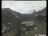
In Hasliberg Wasserwendi, there is the Webcam Weather Hasliberg Wasserwendi (Meiringen-Hasliberg) with motif: Bidmi.
Enjoy the slideshow of this weather webcam.
The webcam Hasliberg Wasserwendi is regularly updated with new pictures.
Track the current weather in Hasliberg Wasserwendi Meiringen-Hasliberg with the webcam HASLIBERG WASSERWENDI.
Weather Webcam Live Cam Schedule plates - Meiringen-Hasliberg (2,250 meters above sea level.): Track time-lapse weather Webcam live weather livecam Planplatten - Meiringen-Hasliberg (2,250 meters above sea level.). Livecam Planplatten - (. 2,250 meters above sea level) Meiringen-Hasliberg situated on a mountain ridge above the main town of the District Meiringen. Hasliberg covers nine kilometers in length and consists of four hamlets Hohfluh, Wasserwendi, Goldern and Reuti.
Video
Video weather Webcam Hasliberg Wasserwendi (Meiringen-Hasliberg)
Slideshow video of weather Webcam Hasliberg Wasserwendi (Meiringen-Hasliberg)video created on 02.12.2014 15:47


.jpg)
.jpg)

.jpg)

.jpg)
.jpg)
